How to Find Location by Latitude and Longitude on Google Maps
Last Updated :
17 Jan, 2024
One of the most popular tools for accessing latitude and longitude data is Google Maps. Latitude and longitude are geographical coordinates that specify a location’s position on the Earth’s surface. In this article, you will walk through getting latitude and longitude from Google Maps, as well as introduce additional topics like finding coordinates from Google Earth and comparing Google Maps and Google Earth.
Understanding Coordinates Format
On Google Maps, coordinates (Latitude And Longitude) are shown in the Decimal Degrees (DD) format.
For example 26.942797 (latitude), 80.906750 (longitude).
This format simplifies the representation of geographic locations, making it user-friendly for navigation and mapping on digital platforms.
How To Get Latitude And Longitude From Google Maps Using Mobile
Step 1: Open Google Maps
Open the Google Maps app on your mobile device.

Open Google Map
Step 2: Search for the Location
Use the search bar to locate the Area that you want to know the coordinates.

Search for location
Step 3: Tap and Hold the area
Now, Tap and hold on to the map to drop a pin, Now you can see the coordinates in Search Bar.
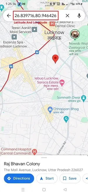
Get Latitude And Longitude in the search bar
How To Get Latitude And Longitude From Google Maps Using PC
Step 1: Open Google Maps
Open the Google Maps website on your PC browser.
Open Google Maps
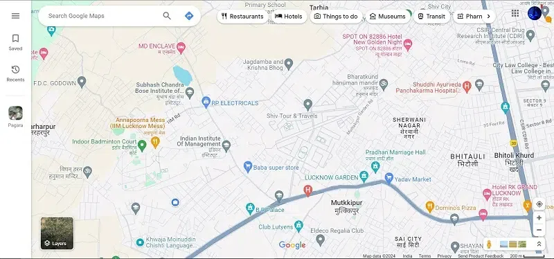
Step 2: Search Location
Use the search bar to find the desired point on the map. and click on search icon.
.webp)
Search for the desired place
Step 3: Right-click the place
Right-click on the place where you what to know the coordinates. You can see Latitude And Longitude or you can choose “What’s here?” which, shows the coordinates in the pop-up windows.
.webp)
Shows the Latitude And Longitude
Another way to find these coordinates is by simply tapping on the area that you want to know about coordinates. the pop-up windows came up that showed the Latitude And Longitude of that location.
.webp)
Can see the Latitude And Longitude
How to Find Coordinates from Google Earth
Find Coordinates from Google Earth Using Pc
Step 1: Open Google Earth
Open the Google Earth website on your PC browser.
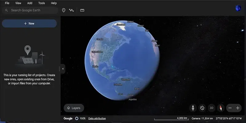
Open Google Earth
Step 2: Search for the Location
Use the search bar to locate the area you’re interested in to get the coordinates within Google Earth.

Search for your location (e.g. Lucknow)
Step 3: Obtain Coordinates
Now, to obtain coordinates on Google Earth, point the mouse cursor on a particular location and you can see the coordinates in the bottom right side corner.
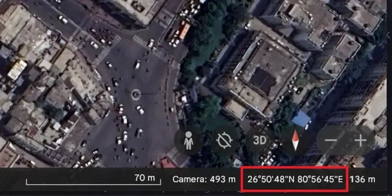
Get the coordinates in right side corner
Alternatively, you can simply right-click on the location and copy the coordinates.

Right-click on the location and copy the coordinates
Find Coordinates From Google Earth Using Mobile
Step 1: Install Google Earth
Install google earth from the play store.
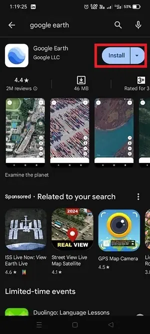
install google earth
Step 2: Open Google Earth
Now, Open the Google Earth application on your mobile.

The home screen of Google Earth
Step 3: Search for the location
Use the Search bar and search for the location you want to get coordinates.
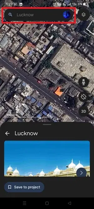
Search for the location
Step 4: Get Coordinates
Long on the Area that you want to get the coordinates.
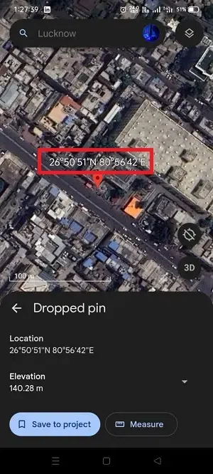
Get latitude and longitude
Google Earth vs Google Maps: What’s the Difference
| It has clean and streamlined interface for navigation. |
it has high quality and immersive 3D interface for detailed exploration. |
| It is primarily focused on navigation and location services. |
It offers a more comprehensive exploration of geographical features, including 3D imagery and historical views. |
| It is ideal for everyday navigation, directions, and local search. |
it suited for in-depth geographical exploration, educational purposes, and visualizing terrain and landscapes. |
Read More
How To Get Coordinates From Google Maps
Conclusion
In Conclusion, knowing how to find latitude and longitude not only from Google Maps but also from Google Earth adds versatility to your location-based activities skill.and Understanding the differences between Google Maps and Google Earth enhances your mapping experience, providing a comprehensive toolkit for geographical exploration.
FAQs
How do I find latitude and longitude on Google Maps?
To find latitude and longitude on Google Maps, search for the desired location, right-click on the map, and select “What’s here?” The coordinates will be displayed in the search bar.
How does Google Earth differ from Google Maps?
Google Earth offers a more immersive 3D experience that allows us to explore geographical features in detail. Google Maps ,focuses on navigation and location-based services.
Can I use the same coordinates from Google Maps on Google Earth?
Yes, coordinates that you obtained from Google Maps. you can use it on Google Earth and vice versa, because they share the same coordinate system.
Share your thoughts in the comments
Please Login to comment...