Stamen Toner ,Stamen Terrain and Mapbox Bright Maps in Python-Folium
Last Updated :
03 Jul, 2020
Folium library is a powerful data visualization library in Python used by people to visualize geospatial data and maps. With the Folium library, we can create map of any location in the world with the help of latitude and longitude of that location. We can also create interesting visualizations by superimposing markers as well as clusters of markers on top of the map. We can create maps of different styles such as street level, stamen map, and Mapbox Bright map. The maps can be created by Folium using the ‘map’ function. The maps are interactive which means we can zoom in and out after the map is created by specifying the zoom level according to our choice. The default map style is the open street map, which shows a street view of an area when we zoom in and show the borders of the world countries when we zoom out. Folium library has various features. One of the most important features is map styles with which we can create different map styles using the tiles parameter. The tiles include stamen tone, stamen terrain, etc. Stamen toner is used for visualizing features like river meanders and coastal zones. Another tile style is stamen terrain which is used for visualizing features like hill shading and natural vegetation colors.
Stamen Toner Maps
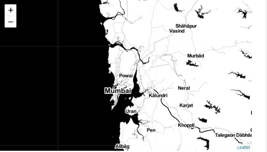
These are high-contrast Black and White maps. They are used for data mashups and for exploring and visualizing river meanders and coastal zones.
Stamen Terrain Maps
These maps are used to highlight hill shading and natural vegetation colors. They showcase advanced labeling features and linework generalization of dual carriageway roads.
Mapbox Bright Maps
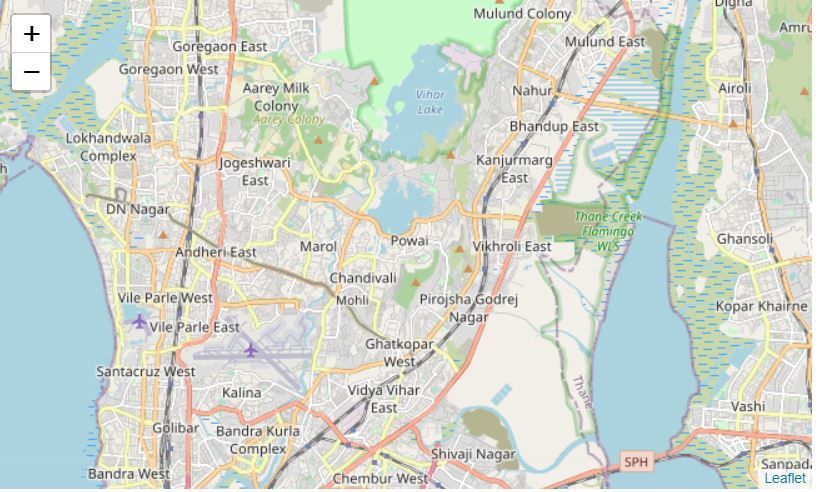
These are maps that similar to the default style, except that the borders are not visible with a low zoom level. They differ form the default style because default style displays country names in each country’s native language whereas Mapbox Bright style tile displays all country names in English.
Example 1: Stamen Tonner map of the world centered around Mumbai
import numpy as np
import pandas as pd
import folium
world_map = folium.Map()
world_map = folium.Map(location =[19.11763765873, 72.9060384756],
zoom_start = 10, tiles ='Stamen Toner')
world_map
|
Output :
Example 2: Stamen Terrain map of the world centered around Mumbai
import numpy as np
import pandas as pd
import folium
world_map = folium.Map()
world_map = folium.Map(location =[19.11763765873, 72.9060384756],
zoom_start = 10, tiles ='Stamen Terrain')
world_map
|
Output :

Example 3: Mapbox Bright map of the world centered around Mumbai
import numpy as np
import pandas as pd
import folium
world_map = folium.Map()
world_map = folium.Map(location =[19.11763765873, 72.9060384756],
zoom_start = 10, tiles ='Mapbox Bright')
world_map
|
Output :
Like Article
Suggest improvement
Share your thoughts in the comments
Please Login to comment...